Please wait a moment while we load the next section.
Section 2: Place Naming Within the New Development


Beyond naming the settlement itself, there is a great deal of further work to do to design, deliver and name places within the new development. This will be a collaborative process and an ongoing task over the years ahead. It is helpful to begin to assemble useful references, sources and think about appropriate influences.
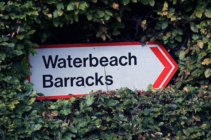
Delivery of the Barracks and Airfield is more advanced than on Waterbeach New Town East. The Urban&Civic team (U&C) - who are bringing forward the Barracks and Airfield development on behalf of the Defence Infrastructure Organisation - is engaged in detailed design and the first parcel developers are now working on reserved matters applications. Place naming is therefore an imminent consideration.
Over the following pages the U&C team present the work undertaken so far to gather relevant references and influences.
Sharing these tangible examples should help to both test the principles and approach taken to date with wider stakeholders and communities; and enable an ongoing discussion, with stakeholders, promoters and the community contributing ideas and information.
Input and ideas for the whole new town are very welcome now or over the months ahead, and can be forwarded at any time to the following address:
Consultees are also invited to respond to Questionnaire B, just in relation to the Barracks and Airfield site.
In time, RLW will undertake a similar exercise, to inform their first detailed proposals. The reference material can then be brought together into one resource.
The reference resource, which is presented here, will expand with consultee responses and RLW input over time and will become an important source of information to draw on as the development moves forward. The District Council and stakeholders will also now consider a protocol for proposing and approving place names. This process will be set out in an update to this document, in due course.
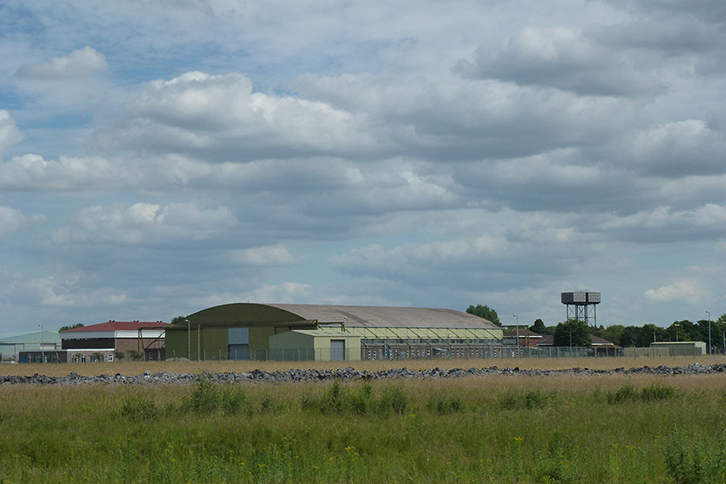
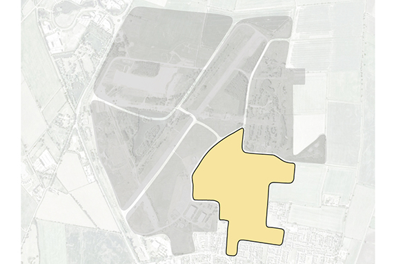
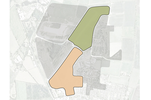
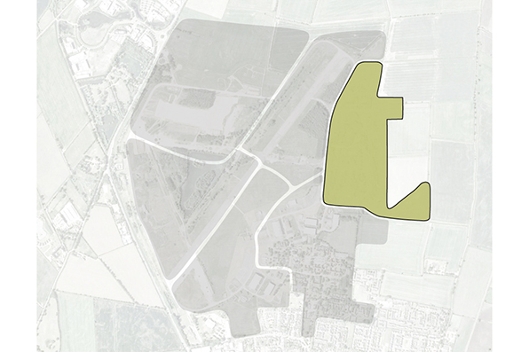
The land of Waterbeach has a rich history which straddles centuries of uses, families and stories: through Saxon and Roman, to medieval farming, the draining of the Fens, and up to 20th century military history. All of this is present in the historic and future layout of the development, and in the uniquely rich landscape which is the legacy of those historic influences. Opposite is a map of the suggested themes and approaches which start to define the character of new areas coming forward within the plans for Waterbeach Barracks and Airfield.
The map uses the character areas defined in the Design Access Statement (of the Outline Planning Application) to set out some core themes, within which we would seek to martial a list of appropriate names and test these with key stakeholders and the wider community. The potential list of names that could sit within each of these areas is grouped into four key areas, which reflect the military, agricultural heritage and ecological connections highlighted in more detail.
These names have the potential to cover street names, names for civic squares and areas, parks and play areas, woodland areas and glades. They also include specific options which could be applied to buildings or civic uses, but it is suggested this is explored through further consultation as detailed designs move forward.
Some features have already been given “working titles” through inclusion in the Design Code, or other planning documents including:
Urban&Civic propose to use the character areas to provide a focus and framework for street and place names which have historic or ecological interity and relevance. Lists of example names which reflect these areas are set out over the following pages.
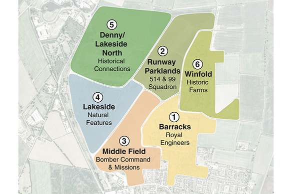
Royal Engineers
The Barracks has a strong character in its layout and existing identity. Streets there could reflect officers of the Regiments based there, roles and nicknames, such as “Sappers”, with additional public realm such as the old parade grounds drawing from their work, missions or mottos.
Click on the links below for names already identified from this approach:
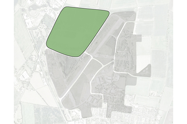
514 and 99 Squadron, Royal Air Force
It is important these areas reflect the military history and the sacrifices made by personnel based here during the War, as this area is home to the former Runway and the Memorial Garden, which will be maintained and designed into the Parkland area. While aircraft names are a common approach on former military spaces in East Anglia, the current preference would be to integrate the names of their designers into commercial or mixed use areas, rather than use the aircraft names. We welcome views on that in the survey at the end of this section.
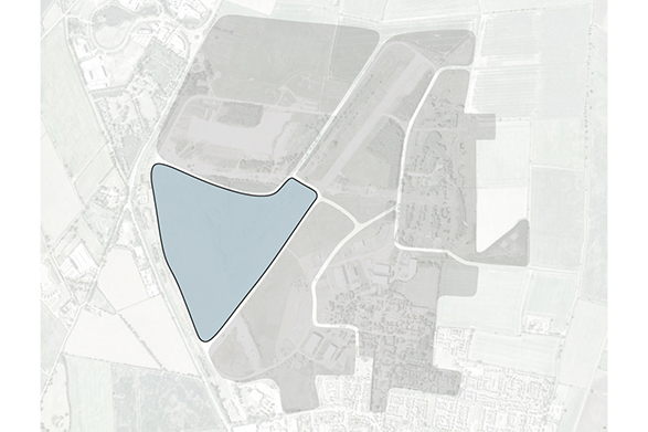
Natural Features
While the man-made lake could have a military connection after the Royal Engineers who created it, the area around it is very natural and we are looking to establish a more natural feel for this area. The proposed approach would take names from landscape features from the historic landscape around the area.
Historical Connections
As this area has been designed to relate to the historic connection with Denny Abbey and looks to the northern parklands above, we are proposing to draw inspiration from the rich history of the Abbey and monastic traditions here and in the local area. Click below for information on the names of
Historic Farms
This area reflects an historic farm which was located in this area, and linking across to the farmland to the East, we are proposing to draw on historic farm names and the families of those who owned and worked the land across this area through the centuries.
Alongside the heritage uses and names, a critical element of the development is the biodiversity approaches and priorities. Part of the approach here will be to engage residents and visitors in the landscape around them and in understanding, supporting and exploring it, to benefit nature and their own health and wellbeing.
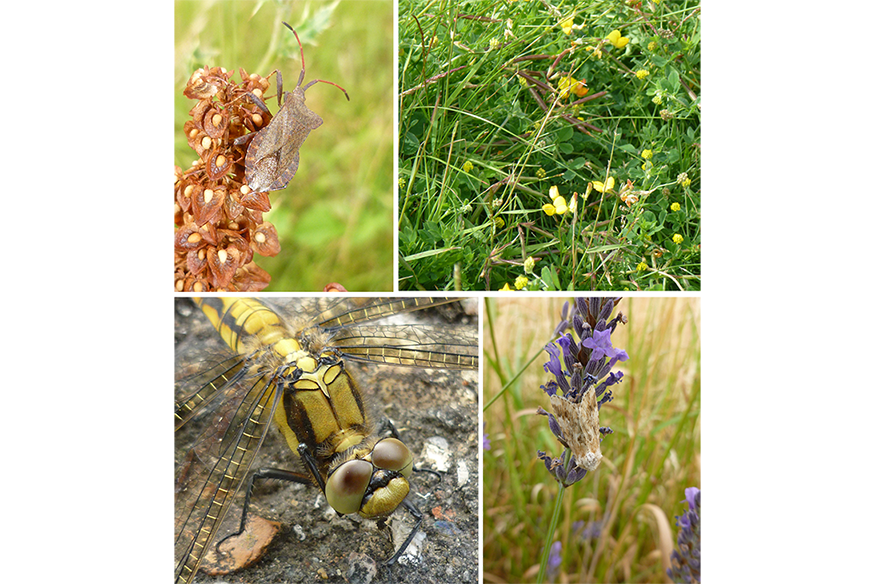
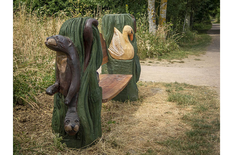
We are agreeing a number of hero species within our wider place making and community strategy which we will feature in walks, wayfinding and welcome packs which help define the role of nature in this nature-led development. We would like to use these names to engage people with the play spaces and walking/running routes around the development, for example:
Kingfisher Walk - the route around the lake will enable glimpses of the kingfishers which live on the island but also keep people away from the more sensitive habitats there. They may include observation points to see them safely.
The play strategy has a number of natural and heritage themes which would explore the woodland glades and paths they sit within to reflect willow, poplar, cherry and birch, acer and alder, with grassland areas celebrating the species of stonecrops, bedstraws and orchids.
The lists below include details of the key species, which we are continuing to refine, but we intrinsically feel these relate best to walks and play areas, rather than street names.
Select a list item to view it's contents.
This survey has now closed.
Privacy Policy
Your information will only be used to contact you about the next steps of this consultation. At the end of the consultation you will be given a choice if you want to receive information about the development going forward or not and if you do not your data will be deleted. Please click the link below to see full details of our Privacy Policy
Caption Here